Info:
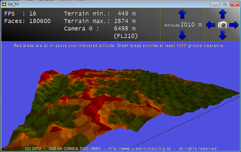
Terrain Viewer Proof-of-Concept. This PoC app displays terrain elevation derived from data from NASA's SRTM shuttle missions. Also it shows how GLB can do what I call 'quasi-multitexturing'. The checkerboard pattern is part of the 3D-object, created by giving individual vertices a colour of their own. The red/yellow/green colouring is done with an additional texture bitmap, which is displayed on top of the checkerbaord pattern. It goes to show that GLB can do both, using vertex colour and using a texture bitmap at the same time...
Download:
oa_terrainviewer.zip - 1.98MB
Author:
Ocean
Homepage:
http://www.ocean-consulting.de/


